 WorldMapper

Worldwide topograph maps of many countries online & offlinen+ many GPS functions
Leer más
Worldwide topograph maps of many countries online & offlinen+ many GPS functions
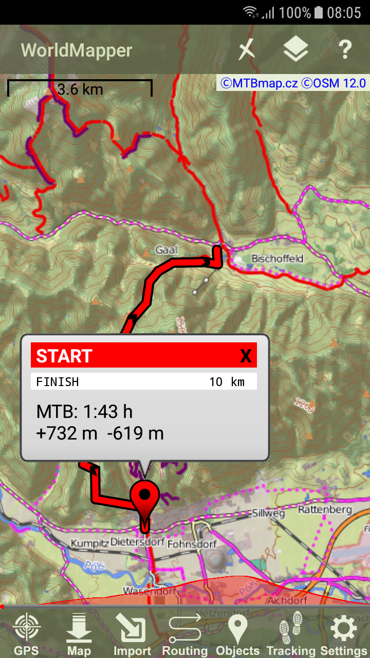
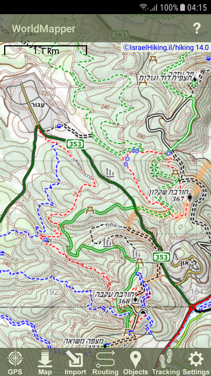
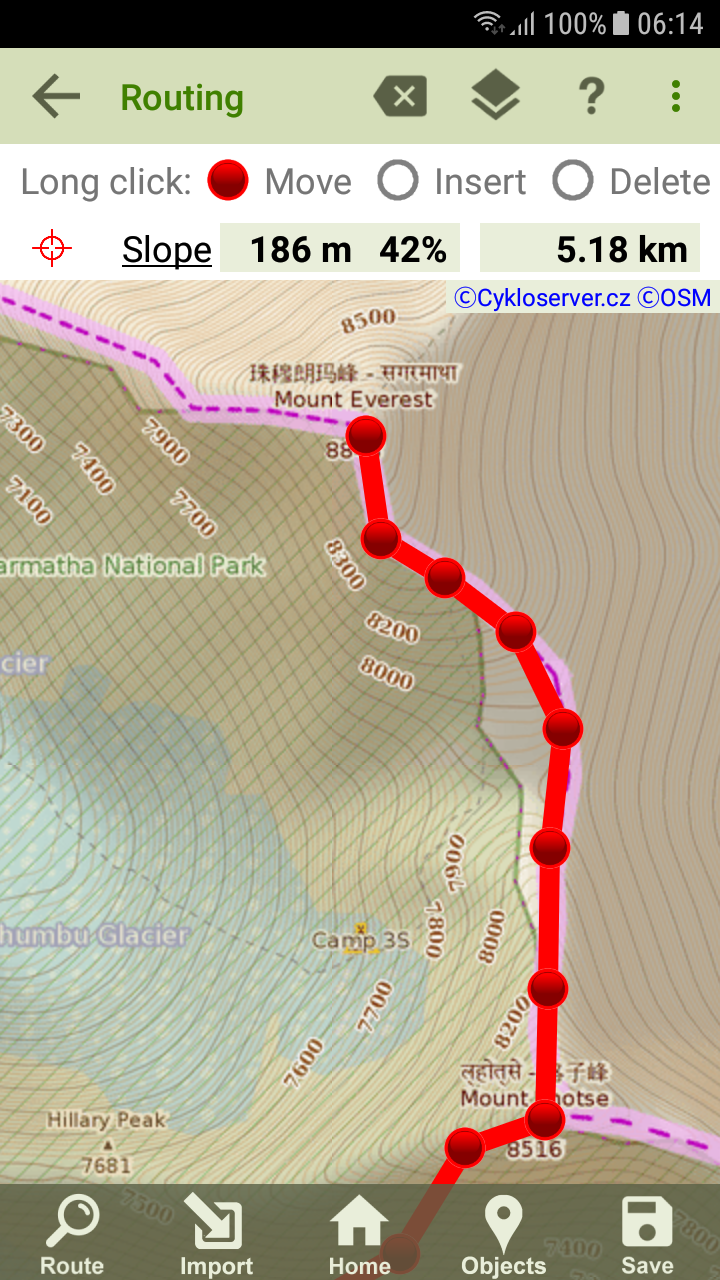
Application for hikers, bikers, moto-bikers, travelers, adventurers and for everyone, who needs perfect maps especially for outdoor activities.The application provides access to the most relevant worldwide online maps, which can be downloaded and saved as offline maps, usable without internet connection. There is around 50 good topographical maps covering whole world, mostly derived from OpenStreetMap. The maps are useable without Internet connection and with the ability to improve their readability on a small screen. The app also contains a lot of GPS and map functionality, including editor for route planning, track recording, voice navigation...Download MapCreation offline maps by downloading is the most relevant feature of this apk. You can define explicitly map source, map area and zoom range. Offline maps work everywhere without internet connection. Created maps are usable in other apks, e. g. Locus, Orux... Printable JPG format is also available.NavigationThe apk provides all functions, what you need in terrain, like voice navigation and watching progress related to the elevation profile. The quality of navigation depends on how you get the route.Routing & Planning + GPX EditorFinds route from point A to point B with option Road - Bicycle - Hiking. Route is calculated by OpenStreetMap or MapQuest server. You can also use comfortable GPX Editor to draw or edit your own route. Elevation profile is generated automatically. Distance and slope measurements are possible. The application supports data synchronization via the Dropbox or Google drive cloud storage.Objects - Points of InterestThe application downloads various types of objects, that are interesting for traveling and outdoor (accommodation and restaurant facilities, water springs, cultural and historical objects...). Optionally, the objects appear on the map.Tracking - Track RecordingThe app records the track, you have traveled. The log contains not only GPS coordinates, but also information about time and altitude. Trackpoints, including title and photos, can be added to the log. Live Tracking lets you track your location on the web server.DashboardIf Tracking is on, you can continuously watch some information as well as a cyclocomputer:- total time- passed distance- climbed up elevation- current slope in %- current altitude- current, max and averge speedSocial NetworksThe application supports access to social networks and enables to share your own routes.Countries Covered by this ApkEurope: Map1.eu, MTBmap.cz, Austria (2), Czech (2), France (2), Hungary, Italy, Norway (2), Poland (2), Romania, Slovakia (4), Spain (2) , UKWorld: ArcGIS, Google, Kompass, Mapy.cz, OpenStreetMap, OpenCycleMap, OpenTopoMap, OutdoorActive, New Zeeland, Israel (2), US (2)Note: Because of possible changes on the map servers, it can happen, that a map is working today, but does not have to work tomorrow. In such case, please, contact author.Also suggestions to include new maps are appreciated.new map format Filessmart watch supportaccess to Google drive & Dropboxvector mapsRUN modevoice navigationmap magnificationdrawing elevation profileGPS sound notificationshow line when trackingdownload map as JPGDashboardShare your trackgetting elevation data from webwatching progress on the route related to the elevation profileimproved GPX track editorbetter map layers managementinfo about found routecategories of points of interestsmooth map rotation